


Les Écrins Valgaudemar ref. Vallompierre et Chambourneou

c.gourme
User
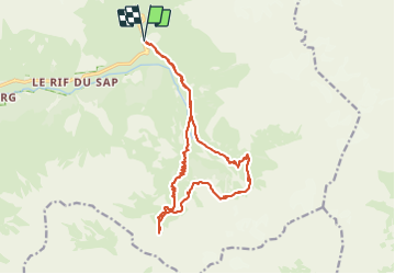

Length
18.7 km

Max alt
2399 m

Uphill gradient
1022 m
Km-Effort
32 km

Min alt
1547 m

Downhill gradient
1022 m
Boucle
Yes
Creation date :
2023-07-13 06:41:18.0
Updated on :
2023-07-16 15:06:59.197
8h39
Difficulty : Difficult

FREE GPS app for hiking
 SityTrail
IGN / Geographical institutes
SityTrail Plus
The world is yours!
About
Trail Walking of 18.7 km to be discovered at Provence-Alpes-Côte d'Azur, Hautes-Alpes, La Chapelle-en-Valgaudémar. This trail is proposed by c.gourme.
Description
On peut passer une nuit au refuge Chambournéou et le lendemain aller au col de vallompierre
Positioning
Country:
France
Region :
Provence-Alpes-Côte d'Azur
Department/Province :
Hautes-Alpes
Municipality :
La Chapelle-en-Valgaudémar
Location:
Unknown
Start:(Dec)
Start:(UTM)
285213 ; 4968298 (32T) N.
Comments